 Lost Springs
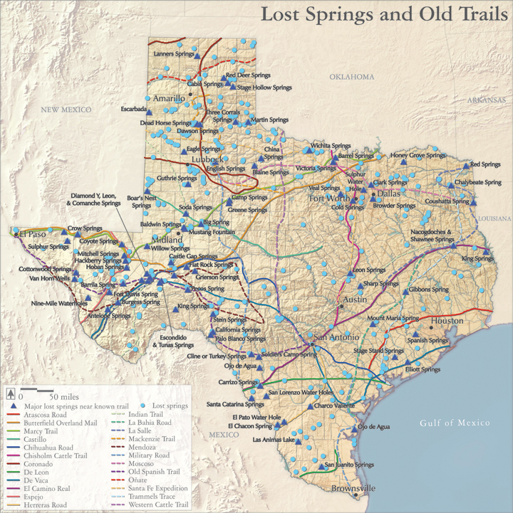
Over 2000 springs have been documented in Texas, and many of them were critical to the early exploration and settlement of the state. Numerous western explorers, including Da Vaca, Coronado, Moscosa, and Espejo during the 1500s, and Onate, Castillo, Bosque, Mendoza, La Salle, and De Leon during the 17th century, relied on these springs.
Later pioneers also depended on Texas springs, as they traveled along El Camino Real, La Bahia Road, the Old Spanish Trail, the Atascosa Road, the California gold-mining road, the Butterfield Overland Mail route, and the Chisholm cattle trail.
With time however, as many as 400 of these historic, and environmentally important, springs have dried up, due to overgrazing, compaction of soils, and overpumping of aquifers.
Audio:
John Carpenter remembers what Comanche Springs, once the third largest springs in Texas, meant to the community of Fort Stockton before heavy pumping led to their demise in 1955.
Map source:
Brune, Gunnar. 1975. “Major and Historical Springs of Texas”, Report 189, Texas Water Development Board, Austin, Texas.
Selected reference:
Heitmuller, Franklin. 2006. “Compilation of Historical Water-Quality data for Selected Springs in Texas, By Ecoregion”, U.S. Geological Survey, in cooperation with the Texas Parks and Wildlife Department.