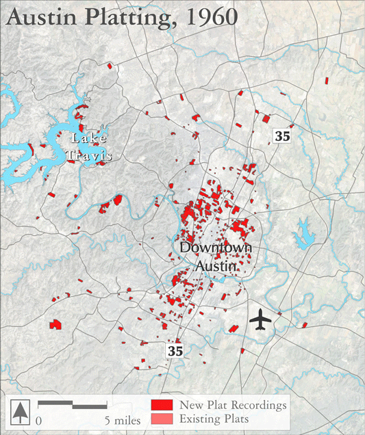
Austin Plats
This animation shows a decade-by-decade series of replatting in Austin, as landowners filed with the City to split up tracts, often prior to development.
This replatting process can be used as one indicator for tracking future patterns of urban growth, as large rural farms and ranches are converted into smaller parcels to later be used for homes, stores, and offices.
The map set can be viewed as a kind of Rorschach test. Some will see it as a sign of the vitality and growth of a community and its economy and tax base. Others will see it as a sign of sprawl, consuming wildlife habitat, watershed acreage and local food resources.
Selected references:
City of Austin. 2014. City of Austin GIS Datasets: Zoning.
Swearingen, W. Scott. 2010. Environmental City: People, Places, Politics and the Meaning of Modern Austin. University of Texas Press.