Drainage & Flooding
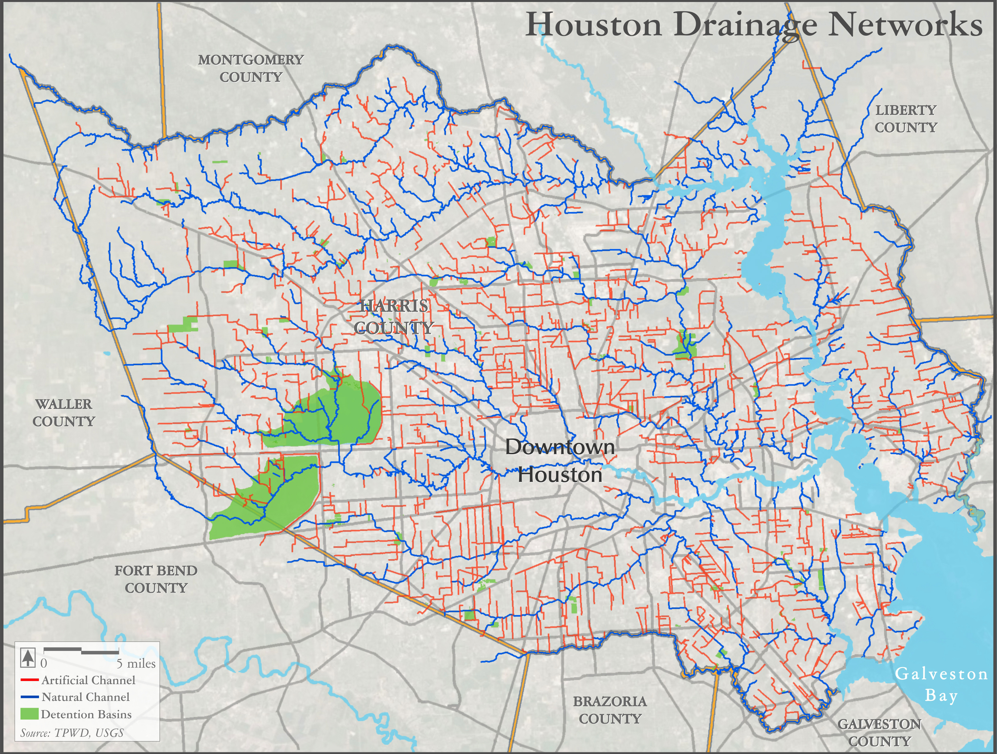
Early settlers saw the Harris County area laced with over 800 miles of small coastal streams, later named Buffalo, Sims, Brays, Green, Cypress, and White Oak Bayous. These streams are shown in blue on this map.
However, as the city grew, the residents of this marshy, flood-prone region saw fit to dig, widen, and concrete-line ditches and channels, to more quickly and thoroughly drain the city. This 2500-mile network of canals is shown in red.
With time, the drawbacks of these man-made drainage systems became more apparent. While the ditches were often successful in shedding water from one area, they often only transferred the floodwaters to another area downstream, in a dance known as the “moveable flood”. As well, critics of the approach of widening, straightening and lining local streams felt that the city was losing some of its richest riparian ecosystems to shovels and dredges.
As a result, recent years have seen the wisdom of the 1940s-era construction of the massive Addicks and Barker reservoirs in limiting flooding in downstream reaches of Buffalo Bayou. Over time, flood management has shifted towards the creation of a network of over 70 large, publicly-managed regional detention basins (shown in green), in addition to hundreds of smaller developer-built ponds, to hold back and slowly release floodwaters when there is capacity in downstream channels.
Sources:
Harris County Flood Control District. 2016. Technical Area: Channel_System_GIS_Data.zip. https://www.hcfcd.org/technical-area/technical-document-library/ (Accessed December 3, 2016).
Texas Water Development Board. 2016. GIS Data: Natural Features – Existing Reservoirs. http://www.twdb.texas.gov/mapping/gisdata.asp (Accessed December 3, 2016).
US Geological Survey. 2016. National Hydrography Dataset. http://nhd.usgs.gov/data.html (Accessed December 3, 2016).