Ogallala Aquifer
Saturated Thickness
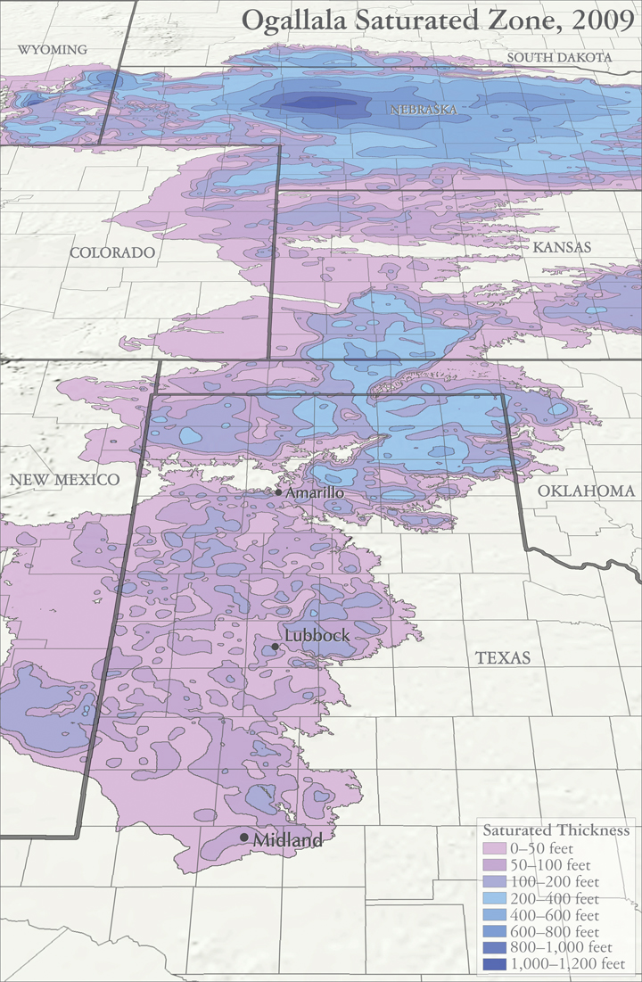
More water is being pumped from the Ogallala Aquifer each year than is being recharged. As result, the aquifer’s watertable is declining at an average rate of 1 foot per year, and in some areas, as much as 8 feet per year. Historic drawdowns have even amounted to as much as 150 feet.
The decline in water levels naturally raises the question of how long this pattern of use can continue. This saturated thickness map gives us some idea. With only 50 feet of saturated strata left in large portions of the Panhandle, and 30 feet of thickness considered the minimum for effective pump use, the aquifer’s remaining lifespan may be as little as 20 years.
Audio:
Andy Wilkinson sings about the “Sandstone Champagne”, the precious waters from the Ogallala aquifer.
Map sources:
Houston, Natalie. 2011. Hydrogeologist, Texas Water Science Center, U.S. Geological Survey. Personal communication, October 2011.
Houston, Natalie, Amanda Garcia, and Eric Strom. 2003. Selected Hydrogeologic Datasets for the Ogallala Aquifer, Texas. Open File Report 2003-296. August 2003.