 Ogallala Aquifer Drawdown
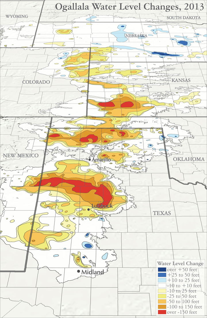
The Ogallala aquifer underlies 41 counties in the Texas Panhandle, and is the principal source of water in that area. Unfortunately, the aquifer has very low recharge rates, maybe 1 inch per year, vastly exceeded by pumpage rates. As a result, the Ogallala has seen average declines of 1 foot per year in Texas. In fact, in some parts of the Panhandle, drawdown of the aquifer has ranged as high as 8 feet per year, and cumulatively, historic watertable declines of 150 feet have been registered.
Audio:
Andy Wilkinson sings about the “Sandstone Champagne”, the precious waters from the Ogallala aquifer.
Map sources:
Barbato, Lucia. 2012. Center for Geospatial Technology, Texas Tech University. Personal communication, October 2011.
Houston, Natalie, Amanda Garcia, and Eric Strom. 2003. Selected Hydrogeologic Datasets for the Ogallala Aquifer, Texas. Open File Report 2003-296. August 2003.
McGuire, Virginia. 2011. Hydrologist, U.S. Geological Survey. Personal communication. September and October 2011.