Houston Subsidence
During the first decade of the 1900s, pumping of oil and gas, and solution-mining of sulfur in the upper Texas coastal plain allowed the underground strata to begin to collapse, and the surface to decline or “subside”.
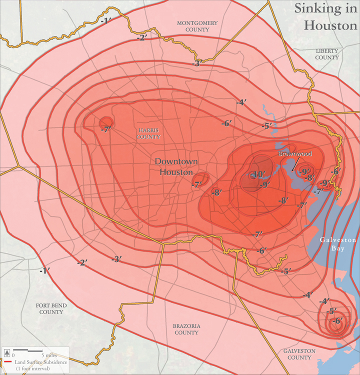
This same problem continued into the 1940s and later, when extensive withdrawal of groundwater for industrial use, municipal supplies, and oil and gas production, led to further subsidence, in some areas as much as 10 feet or more.
This subsidence has altered upland drainage patterns, exposed coastal areas to storm surge, and in those ways, raised flood risks for the Houston region.
The problems with subsidence have been mitigated by reductions in groundwater pumping, and shifts to surface water, although the reservoirs involved have their own impacts.
Map source:
Kasmarek, Mark. 2013. Hydrogeology and Simulation of Groundwater Flow and Land-Surface Subsidence in the Northern Part of the Gulf Coast Aquifer System, Texas, 1891-2009. Scientific Investigations Report 2012-5154, Version 1.1, December 2013. U.S. Geological Survey. Figure 32, p. 47.