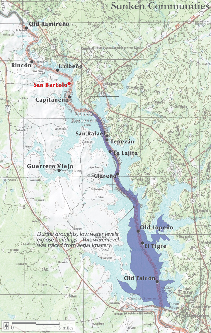
Falcon Reservoir:
The Treaty of 1944 between the U.S. and Mexico authorized Falcon Reservoir on the Rio Grande for flood control, hydroelectricity and water supply.A 26,000-foot, 150′-tall dam was completed in 1953, and rapid rains in August of that year rapidly filled the lake, inundating communities and ranch headquarters first built and occupied in the 1740s.
This map shows some of the major towns and settlements that now lie under the surface of the Lake.
Map source:
George, E. 2008. Lost Architecture of the Rio Grande Borderlands. Texas A&M University Press. College Station, Texas.
Selected references:
Byfield, P.J. 1971. Falcon Dam and the Lost Towns of Zapata. Texas Memorial Museum. Austin, Texas.
Doolittle, W.E., Maldonado, O.I. 2008. Guerrero Viejo: Field Guide to a City Found and Lost. Casa Editorial Hace Poco. Austin, Texas.
Sanchez, M.L., ed. 1994. A Shared Experience: The History, Architecture and Historic Designations of the Lower Rio Grande Heritage Corridor. Los Caminos del Rio Heritage Project and the Texas Historical Commission. Austin, Texas.