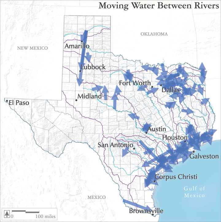
Interbasin Transfers
This map shows the origin and destination for the rights to more than 90 major interbasin water transfers, on record as of the year 2000.
It is good to note that this map does not include all interbasin transfers in Texas: it excludes shifts of less than 3000 acre-feet per year, as well as movements of water between adjoining coastal watersheds, and of course, omits any rights granted since 2000.
Despite the disclaimers, the map does demonstrate how interdependent the various watersheds have become, as many basins export water for use outside their own boundaries. These exports emphasize how large the footprint of major water users has become, often stretching far beyond the immediate area of a city, industrial complex, or farming area. On the other hand, the scale and distance of these transfers is small compared to some of the grand schemes envisioned just a generation earlier.
Audio:
Environmental attorney Stuart Henry talks about the undeniable political and economic power that drives water transfers
Map Sources:
Alexander, Kathy. 2011. Technical Specialist, Water Rights and Availability Section, Water Availability Division, Texas Commission on Environmental Quality. Personal communication. November 2011.
Votteler, Todd, Kathy Alexander, Joe Moore, Jr. 2006. “The Evolution of Surface Water Interbasin Transfer Policy in Texas: Viable Options for Future Water, Water Grabs, or Just Pipe Dreams?” Texas Environmental Law Journal, Vol. 36, No. 3, Spring 2006.