Barton Springs & Septic Fields
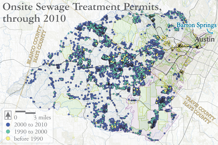
Barton Springs is a much-loved swimming hole and community center for the Austin area, fed by the northern reach of the Edwards Aquifer. The land overlying this portion of the Aquifer is rapidly developing for subdivisions, shopping centers, and office parks. Much of the wastewater from this development relies on septic systems for treatment. These systems sit on top of a porous, fractured limestone substrate that passes groundwater quickly and with little filtration.
In that way, these septic fields threaten to pollute the aquifer that in turn feeds Barton Springs.
Audio:
Bill Oliver sings about Barton Springs, its fun, beauty, history and vulnerability.
Map sources:
This map is based largely on research by Chris Herrington, with the City of Austin Watershed Department’s Environmental Resources Management Division. We are very grateful for his help and advice.
Selected references:
Herrington, C., M. Menchaca, M. Westbrook. 2010. Wastewater Disposal Practices and Change in Development in the Barton Springs Zone. City of Austin, Watershed Protection Department, Environmental Resources Management Division.
Pipkin, T., and M. Frech. 1993. Barton Springs Eternal: The Soul of a City. Softshoe Publishing, Austin, Texas.
Swearingen, W.S. 2010. Environmental City: People, Place, Politics and the Making of Modern Austin. University of Texas Press, Austin, Texas.