 Reservoirs
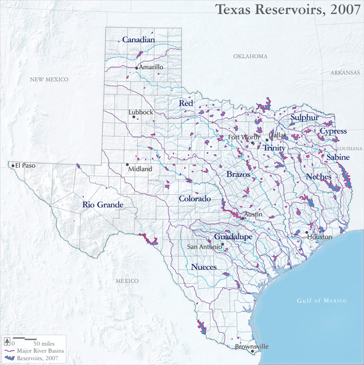
In 1900, Texas had only a handful of lakes. Some were relatively large, such as Caddo Lake, but most were quite small and ephemeral, including Panhandle playas, coastal marshes, and resacas and oxbows along the state’s rivers.
However, with the state’s population growth, industrial development, and significantly, the great drought of the 1950s, a boom in dam construction ensued after World War II, creating over 190 reservoirs exceeding 5000 acre-feet in capacity, with lasting impacts on bottomland hardwoods and estuarine inflows.
Audio:
Veteran Texas Parks and Wildlife biologist Dan Lay explains the short heyday and long decline of Sam Rayburn and Toledo Bend reservoirs –
Audio:
Former Texas Water Development Board director Joe Moore talks about the difficulty and importance of protecting estuarine inflows –
Map source:
Texas Water Development Board. 2014. GIS Data: Natural Features: Existing Reservoirs: Shapefile.https://www.twdb.state.tx.us/mapping/gisdata/shapefiles/reservoirs_2001/existing_reservoirs.zip (Accessed March 4, 2014).