Land and Population
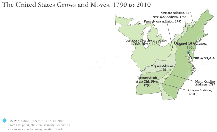
This animated map shows how Texas’ growth has been part of a larger, national population shift as the United States’ acreage and numbers have increased.
We can see how the country’s expansion through conquest, purchase and negotiation greatly expanded the nation’s realm and opened up new western lands, such as Texas, for America’s growing population to settle.
This growth is tracked by movement of the U.S. population’s centroid (the center of the blue circle) over 870 miles west, from Maryland to Missouri, during the 1790-2010 period. Meanwhile, the country’s total population (represented by the size of the blue circles) grew some 80-fold, from 3.9 to 309 million.
Sources:
Gauthier, Jason. 2002. Measuring America: The Decennial Censuses from 1790 to 2000. Appendix A: U.S. Population and Census. U.S. Census Bureau.
Mackun, Paul and Steven Wilson. 2011. Population Distribution and Change: 2000 to 2010. 2010 Census Briefs. U.S. Census Bureau.