Carbon:
With its big, mobile population, heavy industrial base, and high cooling demands, Texas is an energy-hungry place. Much of its appetite is fed by fossil fuels. In fact, Texas CO2 emissions exceed all other states, and rank 7th among the world’s nations.
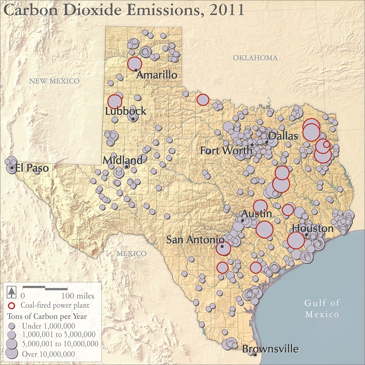
Concerns about climate change have put Texas’ high carbon emissions in the spotlight (the map shows discharges from 770 major stationary sources in the state). Fortunately, there have been some encouraging trends that promise to cut back or at least stabilize Texas’ CO2 releases.
Three changes are particularly exciting. 17 older coal plants in Texas have been scheduled for early retirement, and 19 new plants have been cancelled. Relatively low-CO2 natural gas has dropped 70+ percent in price since 2008, and made major inroads on coal’s power share. Finally, wind energy has boomed, with Texas producing more wind power than any other state, growing seven-fold in just the last ten years.
Audio:
The physicist Gerald North, explains how he came to be convinced about the reality and severity of climate change.
Map source:
US Environmental Protection Agency. 2013. 2011 Greenhouse Gas Emissions from Large Facilities.
Selected references:
US Energy Information Administration. 2013. State CO2 Emissions, 2010
US Energy Information Administration. 2013. Total CO2 Emissions from the Consumption of Energy, All Countries by Region, International Energy Statistics.