The Big Thicket:
The Big Thicket is an extraordinary land of streams, woodlands, prairies, and bogs found in the southeastern corner of the state, home to amazingly diverse plant life, including 85 types of trees, 60 species of shrubs, and over 1000 kinds of flowering plants.
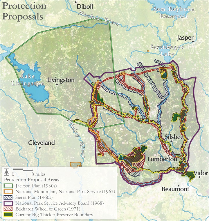
However, the Thicket has been cut for lumber, split by railroads, drilled for oil and gas, and planted for pine. By the mid 20th century, the Thicket’s wilderness, once estimated to cover over 3.3 million acres, had been whittled down to less than one tenth its former area.
Yet the Big Thicket was a nebulous term, a region with no clear landmarks, and no defined boundaries. Advocates for its protection had to work hard, both to fight against the Thicket’s loss, but also to find consensus on which fragments would fairly represent its culture, history, biota, and hydrologic function.
This map shows the diverse plans that were floated by federal, state, and non-profit groups in the decades of ecological studies and political horsetrading running up to the Big Thicket Preserve’s final protection in 1972.
Audio:
Geraldine Watson recalls the debates over how best to protect the Big Thicket.
Selected references:
Cozine, James. 2004. Saving the Big Thicket: From Exploration to Preservation, 1685-2003. University of North Texas Press. Denton.
Gunter, Pete. 1971. The Big Thicket: A Challenge for Conservation. Jenkins Publishing Company. Austin.