
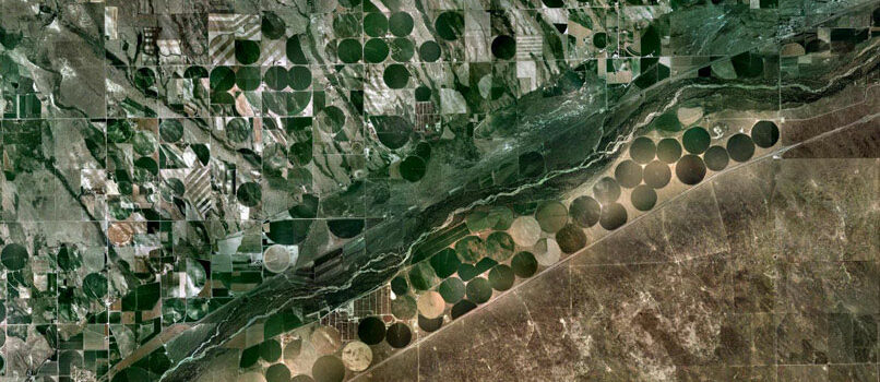
Irrigated Panhandle farms
Palo Duro Reservoir
Ochiltree County, Texas
36.345273 North
-101.202679 West
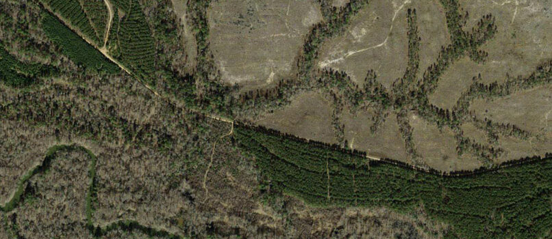
Neches River basin
Maydelle
Cherokee County, Texas
31.757583 North
-95.370519 West
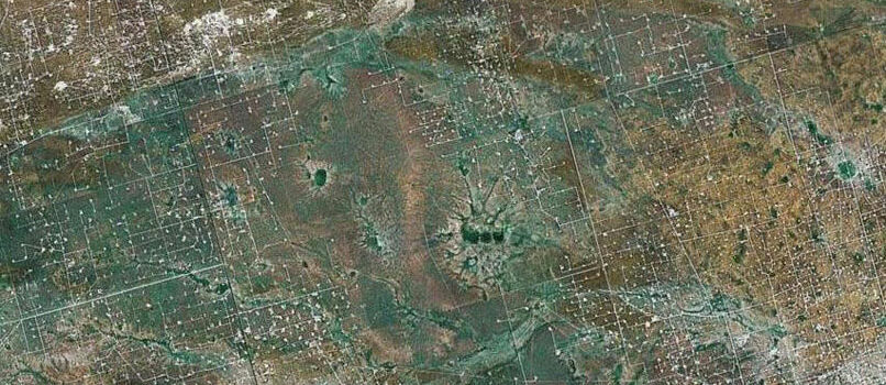
Permian Basin oil/gas wells
Coyote Corner
Andrews County, Texas
32.060464 North
-102.643261 West
The Conservation History Association of Texas is sponsoring the Texas Landscape Project, a multi-media effort to map and track environmental events and conservation efforts in the state. We hope that you will look through this site, consider its maps, text, data and videos, and gain a better understanding of the role of land, water, energy, wildlife, people and health in Texas’ history.
Rimini Wellness 2019: Fitness&Food, an indissoluble union – Osservatorio VeganOK buy trt australia cycle ergometer jk fitness diamond c74 professional